Applications of remote sensing and GIS in agriculture
Explore how remote sensing and GIS revolutionize agriculture by enhancing crop monitoring, yield prediction, and resource management. Discover the latest advancements and applications in precision farming.

Research by ESRI in 2018 revealed that 73% of farmers use Geographic Information Systems (GIS) for crop monitoring. This innovation aids in improving field management, early detection of pests and diseases, and boosting crop yields.
USDA-NASS's 2020 findings show over 50 million acres of U.S. farmland are analyzed using GIS and remote sensing to assess soil conditions and crop suitability.
World Resources Institute's 2019 report highlights that precision farming via GIS and remote sensing can decrease water use by up to 30% and fertilizer consumption by up to 20%, promoting sustainable farming practices.
The evidence supports the effectiveness and bright future of GIS and remote sensing in agriculture. What steps should farmers take to adopt these technologies, and what technical resources are needed? Let’s dive deeper into this topic.
What is GIS in agriculture?
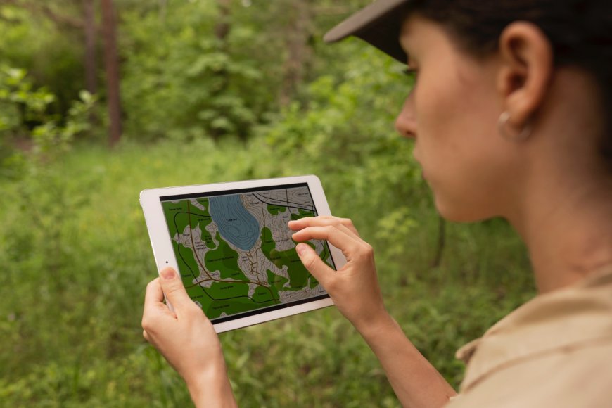
Geographic Information Systems (GIS) in agriculture represent an advanced suite of tools for gathering, analyzing, and presenting spatial data pertinent to farming practices. This technology combines hardware, software, and data to collect, handle, analyze, and visualize geographical information. Within the agricultural sector, GIS serves multiple purposes, offering essential insights and supporting decision-making. Here are key applications of GIS in farming:
-
Soil Assessment: GIS technology analyzes spatial data to chart soil varieties, moisture content, and nutrient levels. This evaluation is crucial for understanding soil health and its appropriateness for different crops, guiding the targeted application of fertilizers and soil enhancers.
-
Crop and Land Management: GIS is instrumental in mapping and tracking crop types, health, and productivity across varied locations. Such data is crucial for fine-tuning crop rotation, planting timelines, and harvest periods.
-
Monitoring Pests and Diseases: Through GIS, patterns and concentration areas of pest and disease outbreaks are identified, informing focused intervention strategies to curb their spread and mitigate crop damage.
-
Irrigation Optimization: GIS aids in the design of effective irrigation schemes by analyzing landscape, soil types, and crop hydration requirements. It identifies zones needing varied water quantities, thus promoting efficient water usage and conservation.
-
Enhanced Precision Agriculture: Acting as a pillar for precision farming, GIS leverages data from multiple sources, like satellites and drones, to conduct field management at a detailed scale. This method ensures accurate delivery of water, fertilizers, and pesticides, boosting yields and reducing ecological footprints.
What is remote sensing in agriculture?
Remote sensing in agriculture involves acquiring data about the earth's surface, encompassing crop health, soil status, and environmental conditions, without direct interaction. Utilized through devices on satellites, aircraft, drones, or other mediums, these sensors gather data across the electromagnetic spectrum, including visible, infrared, and microwave frequencies. Essential for contemporary farming, remote sensing delivers precise, up-to-date data aiding in informed decision-making. Here are essential uses of remote sensing in farming:
-
Crop Health and Management: This technology facilitates ongoing observation of crop vitality and developmental phases. Data analysis on crop reflectance aids in detecting stressors like drought, nutrient lack, pests, or diseases early on.
-
Soil Moisture and Status Evaluation: Remote sensors gauge soil moisture and composition differences, crucial for managing irrigation and conserving soil. This insight permits more targeted water and fertilizer application, catering to the distinct needs of various crop areas.
-
Yield Forecasting: Utilizing past and present remote sensing data allows for the creation of yield prediction models. Such forecasts are crucial for farmers, decision-makers, and supply chain participants in strategizing and planning.
-
Precision Farming: As a fundamental element of precision farming, remote sensing aids in producing detailed maps depicting variables like crop health, soil quality, and moisture content. These maps inform variable-rate technology (VRT) in dispensing appropriate water, fertilizers, and pesticides efficiently, enhancing resource use and lessening environmental degradation.
-
Land Use and Coverage Analysis: Remote sensing offers comprehensive insights into land use trends and alterations, facilitating agricultural land planning and management. It aids in recognizing changes in farming techniques and evaluating policy and intervention impacts.
Qaltivate's team of experts specializes in leveraging remote sensing, GIS, and other cutting-edge agricultural technologies to support agribusiness projects, offering tailored solutions to enhance productivity and sustainability.
What's Your Reaction?
 Like
0
 Dislike
0
 Love
0
 Funny
0
 Angry
0
 Sad
0
Sad
0
 Wow
0
Wow
0


